Beached: A Contrarian Analysis of the Coochiemudlo Island Shoreline Erosion Management Plan
By Peter Wear

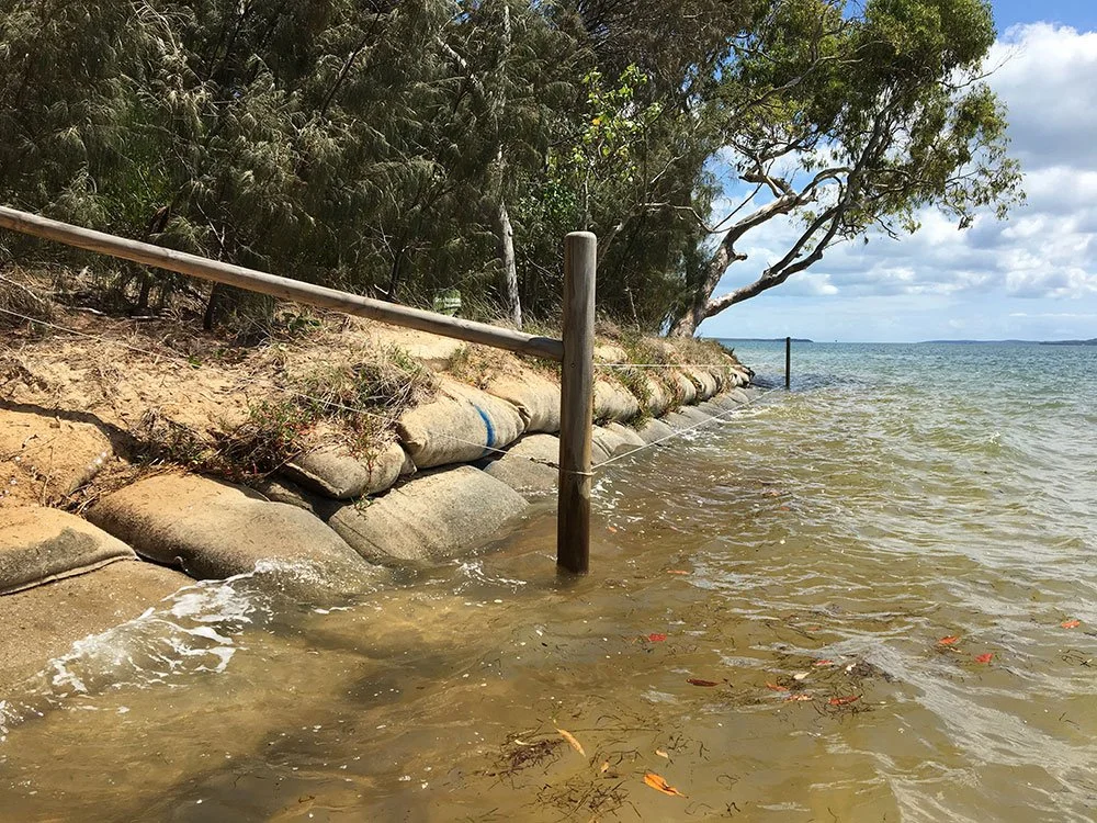
Norfolk Beach, April 2026 | A sandbag wall built by Council in 2014 has deflected wave action, eroding sand from the beach and undermining a bloodwood tree.
Introduction
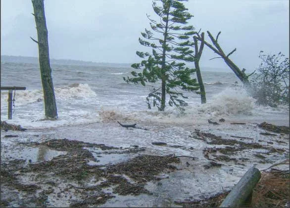
Coochiemudlo’s Shoreline Erosion Management Plan (SEMP) was the major consequence of a heavy storm that crash-landed on the island’s eastern shore, Norfolk Beach, in January 2013.
Eight years later, in February 2021, the final SEMP proposal appeared on the agenda at a Redland City Council meeting. It ran to more than 160 pages. Councillors voted quickly and unanimously to adopt it.
What follows is a record of the SEMP’s development and implementation that underpins my belief that the proposed Plan should have been abandoned long before it came to the council vote.
No inference should be drawn from this article that anyone involved in the SEMP process acted with other than the best intentions, to deliver the best outcomes.
Part 1 – In the beginning
2013–2014
On Sunday 27 January 2013, storm waves atop a swollen high tide swept sand away from the top of Norfolk Beach on Coochiemudlo Island. The storm transformed the beach’s appearance, stripping the dunes, undermining trees, and collapsing a section of the Norfolk track, including its fences.
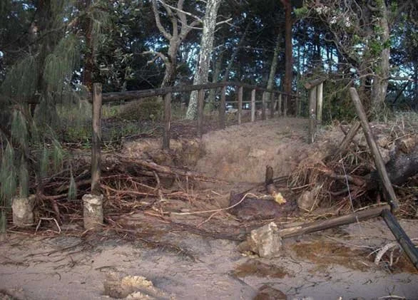
Within weeks, an earth-moving contractor had begun scraping up much of the lost sand from the low tide zone and hauling it back up to the high water mark.
Coochiemudlo Island Coastcare then organised its volunteers into a taskforce that revegetated the restored dunes with native coastal plants.
Their determination and hard work created a lot of goodwill and community satisfaction at having ‘saved the beach’ by Doing Something. That the shoreline had absorbed the impact of such storms for millennia, without human intervention, went unspoken. The sense of purpose among some residents, and their enthusiasm to keep Doing Something, soon gathered momentum.
The call for a SEMP
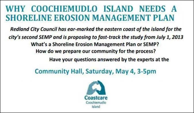
Just three months after the storm, Coastcare declared that Norfolk Beach “needs a Shoreline Erosion Management Plan.” Redland City Council had apparently “earmarked the beach” for a SEMP, and a fast tracked study was proposed. Why Coastcare was the mouthpiece for Council’s intentions, and seemed to have somehow been chosen to “prepare our community for the process”, was not explained.
What Council actually did, some months later, was commission an erosion scoping study of Norfolk Beach by coastal engineers BMT – a global maritime consultancy. It was tasked with identifying the extent and causes of the beach’s erosion, foreshadowing a SEMP to enable Council to manage it. There would be no fast-track. The initial study would take nearly two years.
Let’s build a wall
The beach was already recovering as 2013 came to a close. But on 18 December, at the last Council meeting of the year, Coastcare presented an urgent plea for $20,000 to save trees along the shoreline south of the melaleuca wetlands. An elderly eucalypt, leaning precariously out over the beach, was adjudged to be ‘iconic’.
There was no clear explanation as to how the money would be spent, nor expert confirmation that any trees needed saving. The councillors approved the money anyway.
A few months later, primed by the $20,000, construction began on a sandbag seawall along 60 metres of the beach at the southern end of the wetlands. Council had not sought the mandatory State Government approval. The unauthorised seawall would end up costing over three times the initial $20,000.
Part 2 — The absence of proof
2015 – 2017
In August 2015, BMT’s Norfolk Beach Shoreline Erosion Study was released, the foundation document for this major undertaking. A SEMP is a coastal engineering exercise that typically addresses a retreating shoreline where evidence of ongoing erosion spans decades or centuries. The foreseeable loss of residential buildings and public infrastructure is the usual justification for the high cost of the SEMP, and its subsequent engineering interventions to arrest the erosion.
Norfolk Beach, with no housing within a hundred metres, and only a council toilet block back about thirty, was hardly a disaster waiting to happen. And, already, the beach was recovering well from the 2013 storm. But the 2015 Study had struck a far more serious problem.
BMT’s coastal engineers, after a two year search, had failed to find any defensible evidence of long-term erosion. Bereft of such proof, all they could offer were clues and suggestions.
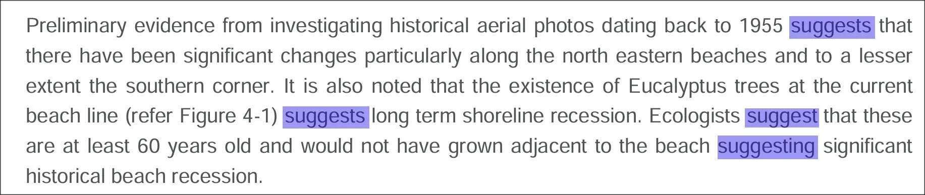
Even the suggestions of historic beach recession (erosion) were compromised because the engineers did not compare the oldest aerial photo, from 1955, with a current one from 2015. That would have required “acquisition of original photographs and accurate geo-referencing.”
The necessary images are easily accessed online. Working with a cartographer, I’ve reproduced the 1955 photo scaled to accurately match its modern equivalent from 2025. The 1955 high water mark (in blue) has been deduced from the vegetation/sand boundary, geo-referenced, and then super-imposed over the 2025 satellite image (ruler in metres). Here’s what has changed over the last 70 years.
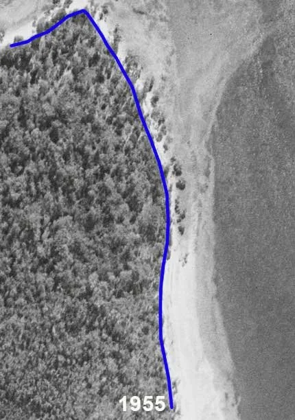
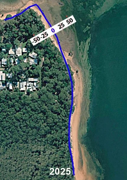
Above: North-east beach highwater marks | 1955 (left); 2025 (right)
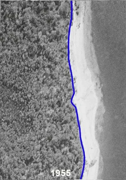
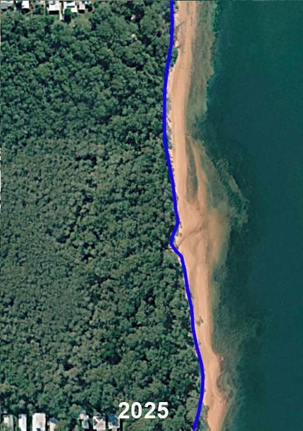
Above: Melaleuca Wetlands beach highwater marks | 1955 (left); 2025 (right)
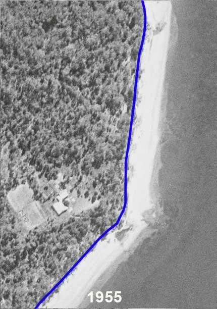
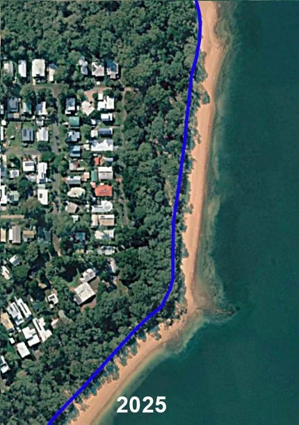
Above: South-east beach highwater marks | 1955 (left); 2025 (right)
These comparisons argue, far more strongly than ‘suggestions’ to the contrary, that the high water mark along 90% of Norfolk Beach has not moved significantly in 70 years. The other 10%, at the beach’s northern tip, eroded about 20 metres from 1955 until early this century, when it appears to have slowed.
Without any credible evidence of ongoing, long-term erosion, or any threat to houses or public assets, Council commissioned BMT’s coastal engineers to embark on a Shoreline Erosion Management Plan. So began five years of costly research, ill-advised beach works, and community disquiet. It would end as it began, with no defensible evidence of long-term erosion — five years of a solution looking for a problem.
Call that erosion? This is erosion!
A comparison with Amity Point, Minjerribah (North Stradbroke Island)
When BMT released their Norfolk Beach Shoreline Erosion Study in 2015, Redland City Council was already developing a SEMP for Amity Point, on Minjerribah. Unlike Norfolk Beach, the justification for a SEMP at Amity ticked every box. The township had lost 100 metres of its waterfront since the 1880s, the erosion had not abated, and for houses close to the shore, rock walls were the last resort against the ravages of the Rainbow Channel.
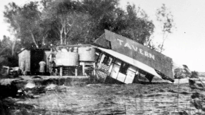
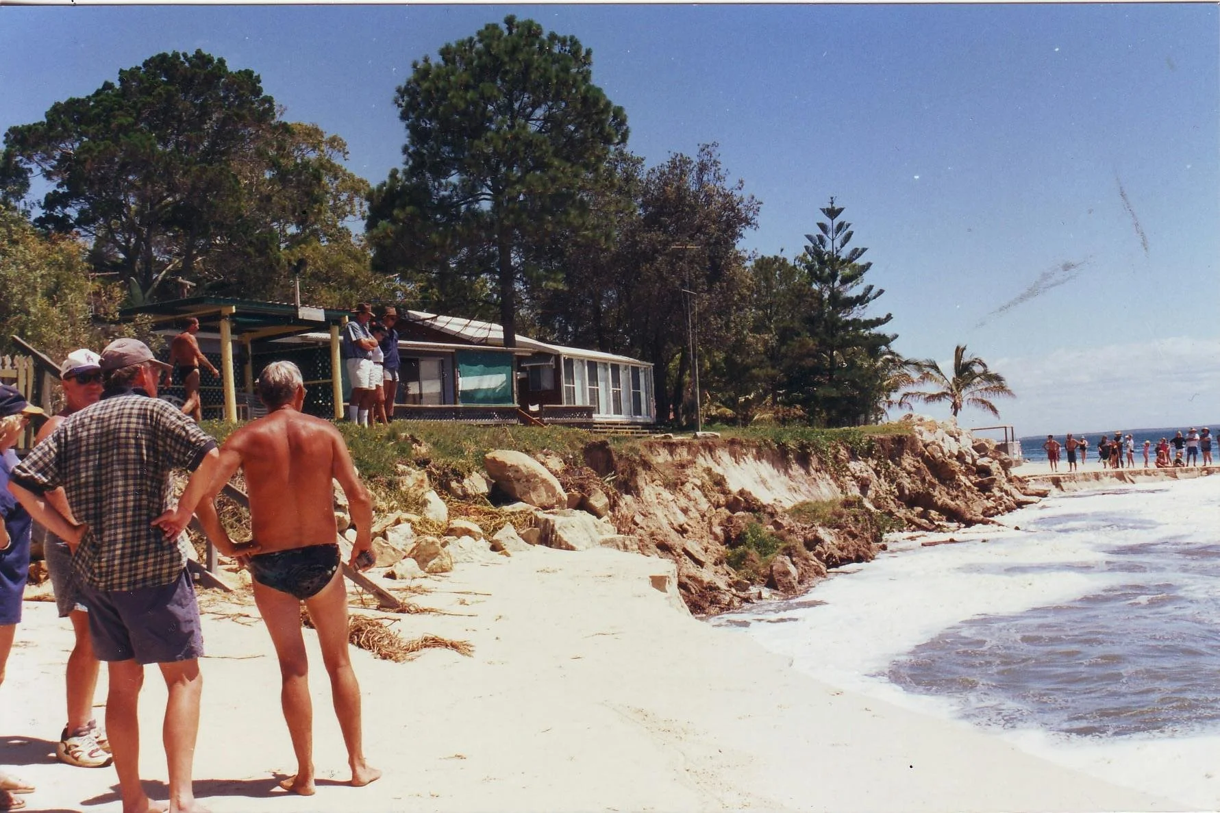
Above: Shoreline erosion at Amity on North Stradbroke Island [Photos: Redland City Council Erosion at Amity Point]
Amity’s catastrophic past, and ongoing exposure to threatening seas, can make Council’s decision to green light a second SEMP for Norfolk Beach, after a single storm, seem almost ridiculous. That Norfolk Beach was soon recovering, with some modest assistance, only adds to that impression.
Little wonder that the 2015 Norfolk Beach study was ambivalent about its ‘suggestions’ that Norfolk Beach was facing an erosion threat even faintly comparable with Amity Point. It was an even bigger ask with nothing older than a 1955 aerial photograph, and so little oral or recorded history of any relevance.
Not only was the Coochiemudlo SEMP crippled by a lack of historic data, environmental science apparently played no significant role in the engineers’ research. To spend eight years producing a plan to manage a natural shoreline, without reference to the relationship between the beach environment and its flora and fauna led, in my view, to the first bad decision in the SEMP’s journey – almost before it began.
The unauthorised sandbag seawall
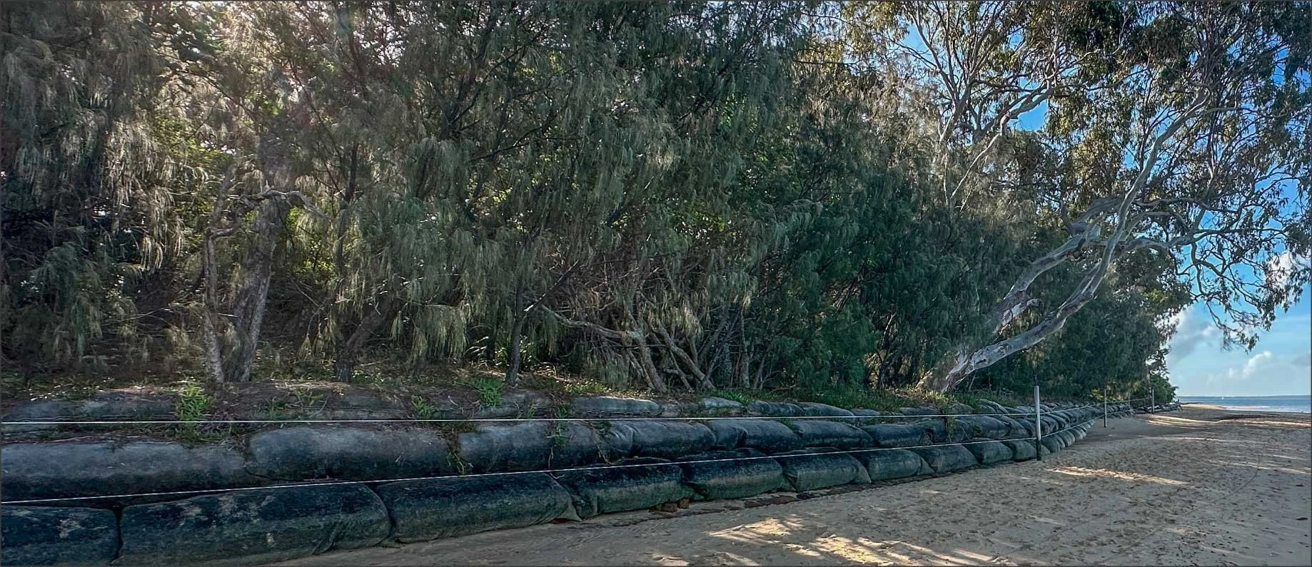
Sandbag wall with the leaning gum tree.
The construction of Norfolk Beach’s 60 metre sandbag seawall, in early 2014, was arguably misguided and ill-informed. Council’s $20,000 handout, in December 2013, was about giving the leaning gum (above) urgent “priority protection”. It was certainly undermined dramatically by the 2013 storm. As was the pink bloodwood tree about 30 metres south of it.
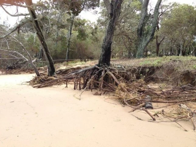
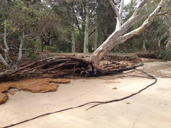
But nine months after the storm in 2013, well before the seawall was built, the roots of both trees had begun to be covered over by the natural process of sand being returned to the top of the beach.
Pink bloodwood (left) and the leaning gum tree (centre right). Photo taken nine months after the 2013 storm.
Neither tree needed the urgent “priority protection”. The photo below, from 2006, shows how similar the beach looked for many years prior to the 2013 storm. The gum tree roots are just as far out of the ground, and the pink bloodwood (red circle) has even more roots exposed above the ground than in late 2013.
The pink bloodwood tree roots, circled in red, have been exposed for many years. [Photo from 2006.]
The community back then had no safety concerns, or perceptions of destructive erosion. As this image shows, they enjoyed the dappled shade under the old tree, a favourite spot, until it disappeared behind a $60,000 wall of sandbags.
And worse was to come. Seawalls are known to create erosion by ‘down-drift’. They concentrate the impact of wave energy and deflect it onto more vulnerable, adjacent locations. That’s exactly what happened south of the Norfolk Beach seawall, where the pink bloodwood tree was well on the way to recovery.
Then, more storms …
In late March 2017, Cyclone Debbie drenched South-East Queensland and created a storm surge that generated a coastal trapped-wave in Moreton Bay. Four days of protracted high winds peaked on the night of 30 March at 93kph, when the tide was well over two metres, atop the storm surge. The beach south of the seawall changed almost overnight.
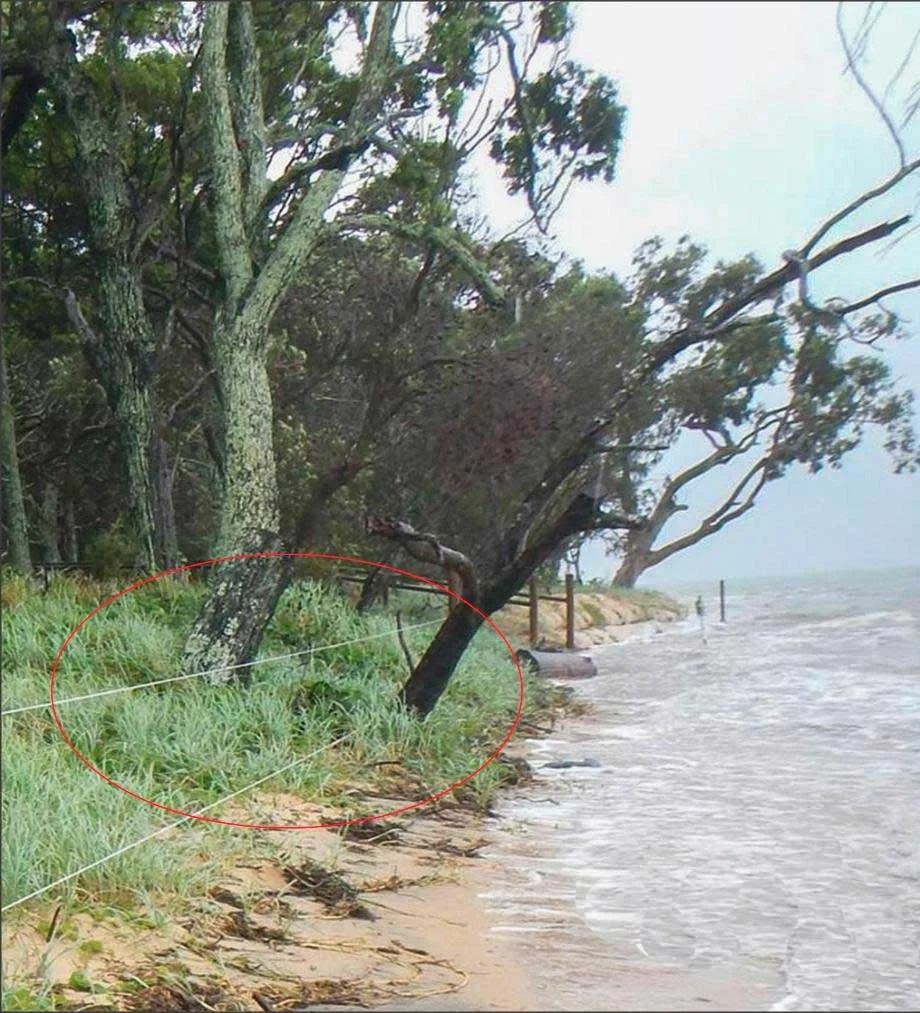
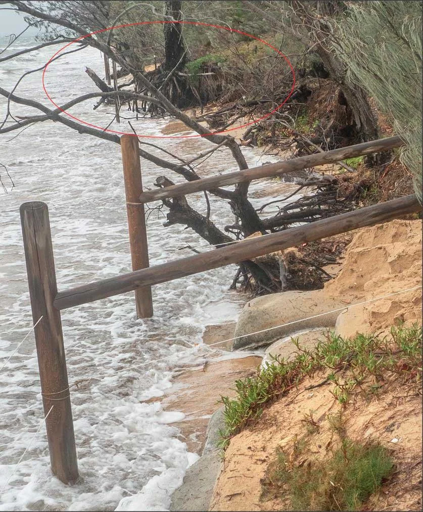
By 2015, the pink bloodwood (red circle) had fully recovered from the effects of the wild storm in 2013. That the storm surge in 2017 left it looking worse than it did in 2013, argues strongly for downdrift from the seawall being the culprit. That likelihood was reflected in the BMT engineers’ repeated recommendations to remove it.
It also explains why the subsequent attempts to replenish the sand cover over the roots of the pink bloodwood and beyond, were doomed. These are described below. The seawall upset the natural equilibrium of the southern beach. Its destructive effect persists to the present day.
On 26 October 2017, the first meeting of Coochiemudlo’s SEMP Community Reference Group (CRG) was held at the Community Hall. Its 19 attendees comprising the Chair (Division 4 Councillor, Lance Hewlett), 3 council officers, 4 Coastcare members, 2 representatives from other local organisations, 6 other local residents, and 3 other contributors.
Part 3 – Bobcats on the beach
2018–2019
On 23 April 2018, a Council contractor’s earthmoving machine appeared on Norfolk Beach. It began scraping up sand from the shallow inter-tidal area and depositing it around trees and over vegetation along the high water mark. A large pink bloodwood tree (first pair below) was targeted.
Almost immediately, high tides began cliffing the dumped sand heaps. As they collapsed, the sand was carried away, leaving the inter-tidal area impoverished. Coastcare volunteers did their best to plant in the heaped sand, but by October almost all of it had been washed away.
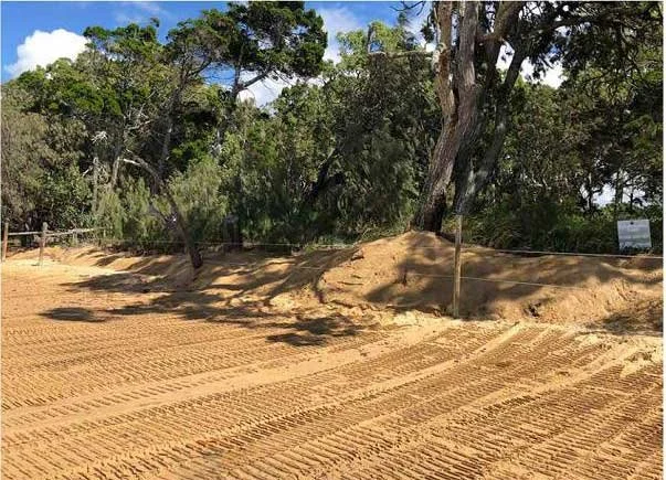
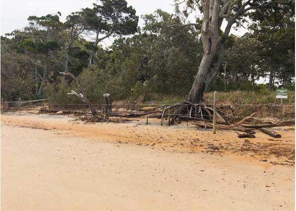
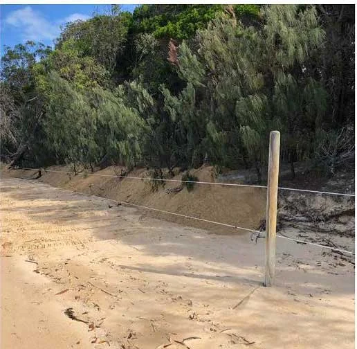
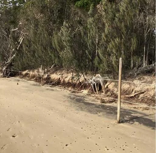
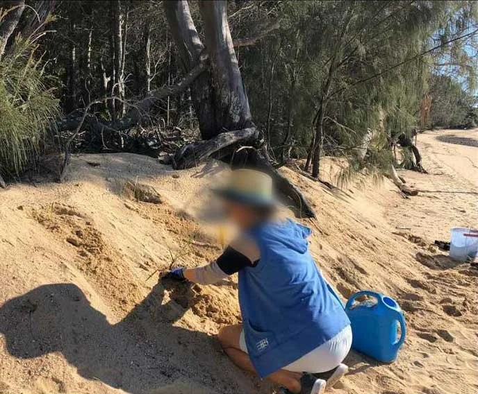
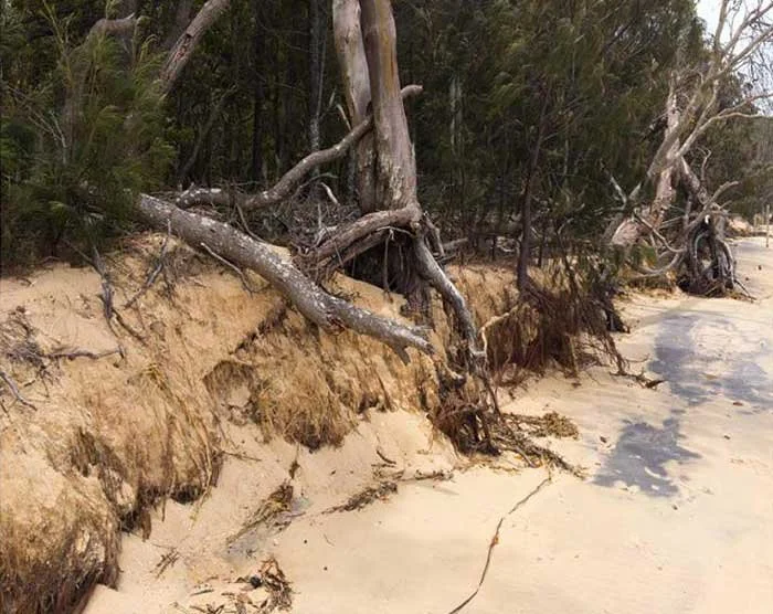
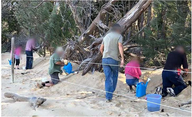
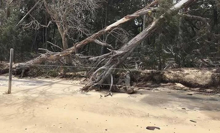
On 18 July 2018, three months after the beach scraping, the BMT engineers attended their first Community Reference Group meeting. They had just commenced a further study that would occupy another 18 months. The 23 April 2018 beach scraping was not mentioned at the meeting. No potential cause of the worsening erosion that triggered it, or reason for the operation’s failure, has ever been published. No one made any connection between the futile attempts to reshape the beach in Location 1, and down-drift erosion caused by the hard seawall, a short distance away.
The following year, on 19 July 2019, the scenario was repeated. A front-end loader hauled sand, recovered from the island’s barge ramp, onto Norfolk Beach. It was then piled it up along the high water mark. Once again, exposed trees, like the pink bloodwood, had sand dumped around their roots.
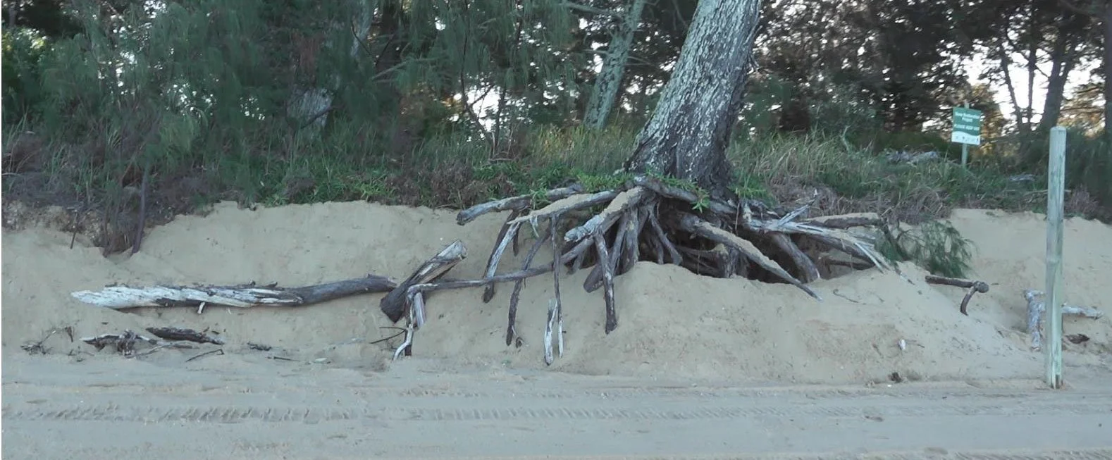
Exposed roots of the bloodwood tree on Norfolk Beach.
Councillor Lance Hewlett, posted a glowing Facebook tribute to these “remediation works”. But he then implied the thousands of dollars had primarily been spent to cosmetically enhance the shoreline’s appearance. This was in readiness for an historic re-enactment on the beach in a few days time. The post read:
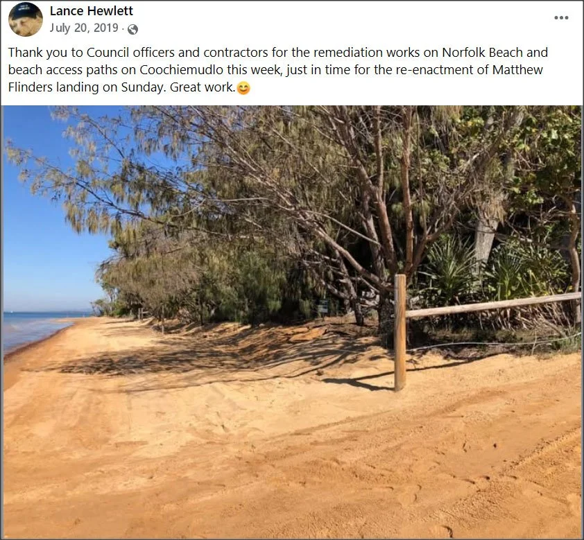
Lance Hewlett’s Facebook post with image of freshly scraped sand over Norfolk Beach, July 2019.
“Thank you to Council officers and contractors for the remediation works on Norfolk Beach and beach access paths on Coochiemudlo this week, just in time for the re-enactment of Matthew Flinders landing on Sunday. Great work :)”
It was not the first intimation that, for some Community Reference Group participants, the SEMP was primarily an aesthetic intervention to freeze the appearance of Norfolk Beach in an idealised vision of what it should look like. Phrases like ‘tending the dunes’ and ‘grooming ’ them, suggested the truckloads of sand were a kind of beach Botox. For others, the sand dumps were an ugly distortion of the beach’s natural character.
Six weeks later, the “great work” had all but disappeared. The down-drift from the nearby seawall was by far the most likely culprit. The roots of the pink bloodwood (far left in the image below) were even more exposed than they’d been in April the previous year.
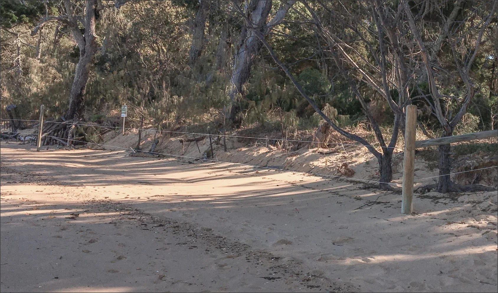
Six weeks after the remidation work, the roots of the pink bloodwood (far left in the image) were again exposed by median tides, waves and wind, just as they’d been in April the previous year.
On 1 August 2019, the Community Reference Group was told that the Queensland government had raised compliance concerns about Council’s sandbag seawall, constructed immediately north of the photo above, in early 2014. Council had never sought the mandatory development approval. And there was still no evidence of any threat to property or infrastructure — the usual justification for a “hard structure” that suppresses the beach’s natural character. Council would now seek a retrospective development application. This would not be advertised. No community input would be invited.
Part 4 – Politics: “Who gets what, when, how”
2020–2021
On 21 May 2020, the first draft of the SEMP was released including its full rationale and operational recommendations. This was a milestone. The first draft of the SEMP, including its full rationale and operational recommendations, was released on 21 May 2020.
On 16 June 2020 it came before the Community Reference Group. The draft’s highest priority was maintenance tasks, such as removing trees and formalising access paths . Costly, non-essential works, like beach scraping or nourishment after storms, were given the lowest priority. Retaining the sandbag seawall was, conspicuously, placed last.
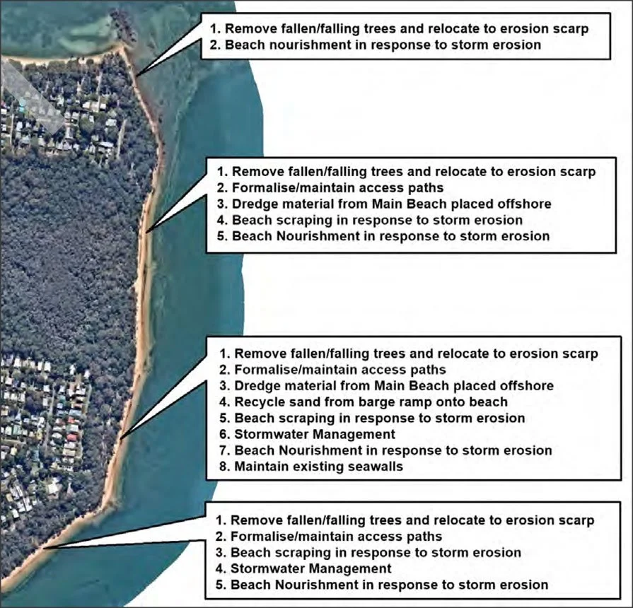
Numbered list of SEMP priorities allocated to four sections of Norfolk Beach: Beach nourishment is positioned as lowest or second lowest in each of the sections.
The Community Reference Group divides
But when the Community Reference Group saw the SEMP’s priorities, the meeting was riven by sharp disagreements. Some members were convinced Norfolk Beach was in the grip of long-term erosion, and were dismayed to find that beach nourishment had been ruled out as a pre-emptive defence against the next storm of 2013’s ferocity.
The engineers, however, unable to find any proof of persistent historic erosion, could not condone dumping imported sand on an apparently healthy beach. The fractious CRG meeting ended (as minuted) with this exchange between the lead coastal engineer and a member of the Coastcare executive.
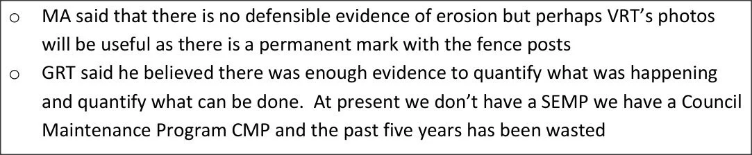
Snippet from Community Reference Group minutes: MA — initials of BMT representative; GTR — initials of Coastcare member
A rabbit jumps out of the hat!
Just two months later, the dashed expectations of Coastcare, and presumably other reference group members, rose from the dead. On 26 August, a revision of the SEMP appeared, with the engineers now embracing a far more ambitious and costly schedule of beach works. They had been apprised of “recent unaddressed storm erosion on Norfolk Beach”. While the beach would still recover “given sufficient time” that was no longer the preferred option because “concerns have been raised by community members that if no action is taken erosion will be exacerbated by future storms ”.
There was no indication that the engineers shared these concerns, and their original priority list implies they didn’t. These eleventh-hour changes called for large amounts of sand to be imported to energise Norfolk Beach’s recovery. The former top priority, removing fallen trees along the beach, had vanished never to be seen again. In its place was a prescription for enough beach sand to fill an Olympic swimming pool.

Line item in the revised list of SEMP recommendations indicating the prioritised beach nourishment at a cost of $170,000.
And there’d be no waiting for a storm to trigger it. Immediate nourishment by 2,400 cubic metres of imported sand would occur in front of the wetlands, and south of the sandbag wall for another 190 metres. Covering the “unaddressed storm erosion” with tonnes of imported sand, was estimated to cost $170,000. And it had to happen soon, before the summer storm season. It didn’t.
It wasn’t until 17 February 2021 that the SEMP’s recommendations came before a full council meeting and were unanimously adopted. The council officers’ report explained the SEMP was primarily driven by “a strong desire to preserve the current shoreline alignment and to preserve the amenity of the sandy beach”. This strong desire had come from “the community through the reference group”. It almost sounded as if Council was powerless to resist. As well, $350,000 would now be spent, once every 5 years, to accelerate Norfolk Beach’s natural recovery and buffer it against “subsequent erosion”. This was on top of the $170,000 “to address community concerns about existing conditions” — in total, well over half a million dollars.
Too little, too late
2023
Two and a half years later, the beach works tackling the urgent “unaddressed storm erosion” finally commenced … sort of. The BMT engineers had speculated that sand dredged from the Bay could be pumped onto the beach for about $30/cubic metre. Allowing $70/cubic metre, for contingency, had produced the
$170,000 estimate for the prescribed 2,400 cubic metres.
But when Council officers set about sourcing suitable sand, they found that COVID-driven market forces had wildly affected the cost. Sourcing sand from the only suitable supplier, a sand mine 90 kilometres up the north coast, would increase the spend from $170,000 to $250,000. But that would only buy and transport 430 cubic metres — less than 20% of what the experts had specified. Council took it anyway.
In late June a convoy of trucks set out on the three hour round trip between the sand mine and the Victoria Point jetty. Even though their payload was far less than recommended, the overall cost had taken a significant hike. By the time the sand was dumped on Norfolk Beach every cubic metre had cost not $70, but $580.
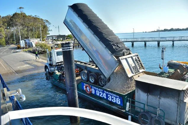
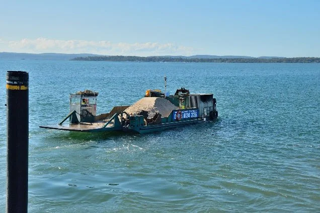
Above: Bringing sand to Coochiemudlo Island [Photos: Gary Sheehy]
Once the sand arrived on Norfolk Beach, Coastcare seemed to be in charge of its dispersal along the wetlands beach front, north of the ephemeral creek. They reworked some of the sand piles into a semblance of what they referred to as a “new dune” and set about vegetating it with 2,500 plants.
Some sand was never deployed, and remained in the heaps in which it was unloaded from the barge.
But, there’d be no repeat of Coastcare’s conspicuous success restoring beach vegetation after the 2013 storm. Within days, the ‘new dune’ was considerably depleted, and many plants lost. A succession of nightly tides that were high, but not abnormally so, peaked in early July at about 2.8 metres.
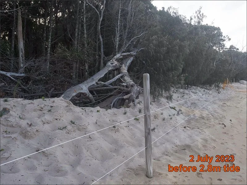
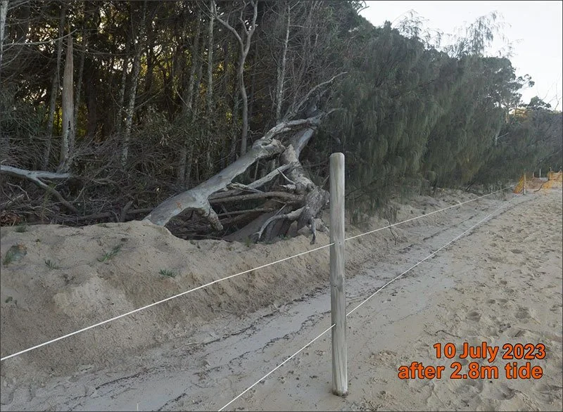
Above: Images demonstrating sand depletion one week after dispersal and a high tide.
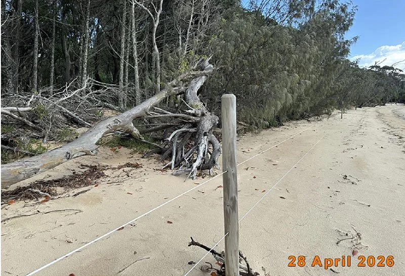
The same section of Norfolk Beach shoreline in 2026.
Today, thirteen years after the Coochiemudlo SEMP process began, evidence of its only tangible outcome, the beach nourishment three years ago, has all but disappeared. The piles left on the beach as the barge unloaded are long gone too. There was initial optimism that the imported sand might have been pushed around by the tide, but not lost to the beach.
However, measurements of the high water mark since 2021, using fence posts as datums, show neither consistent seaward nor landward movement, nor changes in median sand depth around the posts that line the beach front. If the sand is still in play, where is it?
Those who are dispirited by how the beach looks in 2026, may continue to blame long-term erosion for the fallen trees and constant changes that characterise a dynamic shoreline. But the fact remains that the high water mark, clearly visible in the photo above, has hardly shifted from the best estimate of its location in the aerial photograph from 1955. That’s 70 years of stability.
The comparison with Amity Point could hardly be more stark.
Postscript
The Coochiemudlo Shoreline Erosion Management Plan was tabled in 2021, at Redland City Council’s February meeting. A Council officer, explaining the wholesale, last minute changes to the Plan, told councillors “… the community through the Reference Group had expressed a strong desire to preserve the current shoreline alignment and preserve the amenity of the sandy beach”.
He did not say at what point the Reference Group had united behind this ‘strong desire’. It is not recorded in the minutes of the eleven Community Reference Group meetings. Nor, to the best of my knowledge, did anyone genuinely representing “the community” – the rest of us on Coochiemudlo – ever become aware of the sudden SEMP changes, let alone express “a strong desire” to support them.
I suspect the Community Reference Group failed to represent the range of informed opinions island residents expressed in social media and elsewhere. That Councillor Hewlett chaired the Community Reference Group, and championed views that coincided with those of Coastcare, may have skewed Council’s perceptions towards operational choices that did not reflect a majority community view.
That those choices contradicted the preferred, long-term recommendations of the expert consultants is perhaps even more regrettable. Following convention, councillors were provided with a voting option - rejecting the SEMP. It ran to just 44 words:
“That Council resolves to allow the natural coastal processes to eventually restore the beaches of our naturally wonderful environment and not adopt the Coochiemudlo Island Shoreline Erosion Management Plan. To support low scale management of the foreshore on Coochiemudlo according to existing management practices.”
That option, which would have saved hundreds of thousands of dollars, did not find a single supporter around the Council table.
Peter Wear
Coochiemudlo Island
Peter Wear worked for decades as a journalist and TV current affairs producer. He has lived on Coochiemudlo Island for 20 years.
Except where stated otherwise, Peter Wear took the Coochiemudlo Island photos in this story.