The Origin of the Emerald Fringe
By Keith Slack (cartographer, member of Coochiemudlo Island Heritage Society)
Early days and surveys of the island
In 1841, Coochiemudlo Island was first charted on a map of Moreton Bay produced by Robert Dixon. Dixon had been the surveyor for the Moreton region and he named the island Innes Island after Lieutenant Joseph Long Innes of the 57th regiment of Moreton Bay, an explorer of the area surrounding the settlement. Dixon produced the map while he was under suspension so it never received official sanction. By 1885 the island’s name had reverted to the Indigenous name Coochie Mudlo.
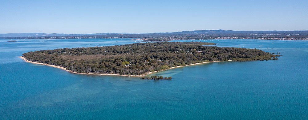
Aerial view of the north west of Coochiemudlo Island that illustrates the Emerald Fringe around the shoreline. Photo by Adric Spiteri (Sure Shot Film).
In late 1885, the Queensland Surveyor General’s Department issued an instruction to George Thomas McDonald to subdivide the western half of Innis/Coochiemudlo Island into one-acre blocks for auction sale. McDonald, a surveyor from Scotland, had come to Australia in 1853 and worked in the Victorian Surveyor General’s Department. In 1878, following the Black Wednesday sackings of 400 top public servants, he moved to better pastures in Queensland where he worked as a contract surveyor for the Surveyor General’s Department in Brisbane. A short notice in the Brisbane Courier Mail welcomed him with the following statement:
“We note that Surveyor George McDonald has recently moved to Queensland to practice his profession among us. We hope that he will find the Queensland public a better and more reliable employer than the Victorian Government.”
Nine years prior, in 1878, a notice from the Brisbane Surveyor General’s Department had made it mandatory, when surveying crown land, to leave a minimum setback of 150 links (30 metres) from the high water mark. This minimum setback was designated as an esplanade and its tenure as road reserve. As it turns out, on Coochiemudlo Island this esplanade in excess of 50 metres wide in some sections around the island.
Image: Town of Coochie survey from the nineteenth century illustrating the area set as an esplanade around the island — from the shoreline to the first surveyed blocks on the west of the island, and the yet-to-be surveyed area in the east.
In 1916, unsurveyed crown leases were issued to the east of Elizabeth Street and the esplanade was extended to encircle the island entirely. This action completed the esplanade around the circumference of the island, creating a unique asset with dense tree coverage that has been spared from development.
Local heritage listing of the Emerald Fringe
The green buffer around the island has appropriately been named the Emerald Fringe. In the 1990s, the roadway was excised from the esplanade, leaving the balance area of the esplanade as Lands Department environmental leases with the Redland Shire as trustee. This is the situation as it stands today.
The Coochiemudlo Island Heritage Society applied for heritage listing of the Emerald Fringe. In 2019, the area from the property boundaries to the high-water mark was listed as local heritage by the Redland City Council.
As residents we are blessed to live in a community that is surrounded by the sea as well as a forest, with only a short walk to both.

